Sunday, October 11, 2009

Pennine Way 17 Dufton to Garrigill

Today's walk promised to be a hard one as it covered the highest point on the Pennine Way, was 16 miles long and involved around 3000ft of climbing. The 'B' party had the option of taking a mini bus covering the first 4 miles and the bulk of the climb. I decided with some of the 'B' party to join the 'A' party for this walk and hope that we could keep up!

We set of at a brisk place in almost fine weather, just a passing shower and a bit of mist around. It wasn't long before the usual 'A' party members were well ahead of the 'B' s that had joined them but at least the leaders Malcolm and Steve were kind to us and gave us encouragement to carry on.


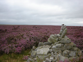
We made our way steadily upwards passing numerous cairns to Knock Fell (2604ft) and then to the radar station where we stopped for lunch with views of Cow Green reservoir in the distance.


After lunch the final push to Little Dun Fell (2761 ft) and the shelter on the summit of Cross Fell (2930 ft). Yes it was quite a hard slog for me but the sense of achievement made it worthwhile.

After a moment to draw breath, touch the trig point and admire the view, off we set again down hill thankfully with wonderful views all around us. A short visit to Greg's Hut, a mountain bothy that would have been a haven in bad weather but fortunately not needed by us on this occasion!


The rest of the walk sounds easy, all down hill, a miner's track to follow, easy-peasy! However the miner's path, known as the Corpse Road, goes on for seven long miles down to Garrigill and for the most part is a rough stony surface that punishes the soles of your feet and ankles. Thankfully the weather was still good, the views were splendid and we chatted to each other along the way to help pass the time. The people at the front of the 'A' party only just caught the 'B' party before they reached the end of the walk.
At last the sleepy village of Garrigill came into view and a chance to sit for a while on the village green and reflect on a good weekend's walking and 29 more miles of the Pennine Way under our belts!

On the coach at last, a very friendly group, shared their remaining food and drink as William drove us safely home again. No more Pennine Way walks now until next March, so hopefully all the winter weather will have gone by the time we return to Garrigill in 2010.
Thanks to Peter who took all today's photos. I didn't have the energy for photos and climbing hills!

Pennine Way 16 Langdon Beck to Dufton

A hard weekend ahead of us as we set off on Friday evening to stay in Dufton or near by in Appleby. I stayed in the YHA at Dufton and was lucky enough to see a red squirrel in the garden on Sunday morning!


It took us quite a while to reach Langdon Beck on Saturday morning and we were all relieved to pick up where we left off last time and head off into the wilds of Upper Teesdale. Here we walked beside the winding river which was quite difficult at times crossing numerous rock falls.

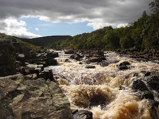
And then suddenly the river bends to the right and the noise of Cauldron Snout can be heard as it rushes down a rocky gorge. Quite a steep and exciting climb up the side of the waterfall takes you to the dam wall of Cow Green Reservoir where we stoppd for a lunch break.


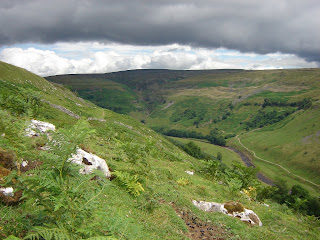
After lunch we left the River Tees behind us and followed Maize Beck until it reached the highlight of the day High Cup NickThe views were incredible and Peter has taken some splendid photographs of this vast glaciated bowl.


We followed the north rim of the valley with the silvery thread of High Cup Gill glinting in the sunshine far below. A few miles further on we dropped down into Dufton where a tepid shower (if you were lucky!), and a blazing fire awaited us. We spent a very pleasant evening chatting, eating and drinking before retiring to bed to get a good night's sleep before the next demanding day on the fells.

Sunday, September 13, 2009

Pennine Way 15 Middleton in Teesdale to Langdon Beck


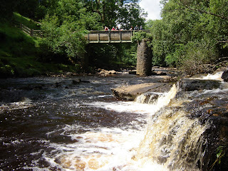
Today's walk was a very peaceful one beside the River Tees for most of the day. The weather was kind to us again and the sun came out later in the day. A short walk but a very beautiful one with the main attractions being the waterfalls of Low Force and High Force. I will let the pictures of the river in all its moods tell their own tale.

High Force is the highest unbroken fall of water in England at 70 ft (21 mtrs).

Sunday, August 16, 2009

Pennine Way 14 Pasture End to Middleton in Teesdale

At last our luck with the weather ran out and although it was the middle of August it felt more like the start of autumn and the promise of a better afternoon never arrived until we were on the bus home. I didn't take many photos today but if you click on this link you can see many more.

A fairly short walk today and because of the lack of sunshine the views of the reservoirs and Hannah Hauxwell's house were not particularly inspiring, The beautiful meadows of wild flowers that surround her house were long gone unfortunately but we were rewarded with the first heather of the season on Bowes Moor.


We stopped for a lunch break in the shelter of the wall at Baldersdale and this spot marked the half way point of the Pennine Way....only 128 miles to go!!


Its amazing how the weather affects the mood of the group and although it wasn't raining very hard and it wasn't particularly cold the mood was rather low key today and it didn't really improve until we reached the end of the walk and the cafe at Middleton in Teesdale that was just about to close until we all trooped in and took over!


So not as picturesque as Swaledale but we have reached the river Tees and are looking forward to a riverside walk with plenty of waterfalls to come.

Sunday, July 19, 2009

Pennine Way 13 Thwaite to Pasture End

The more observant of you might have noticed that Pennine Way 12 is missing. No we haven't missed a section out, we started where we finished last time, it's just the numbering in the booklet that went a bit wrong. Perhaps if it had been called correctly number 12 we may not have had so many accidents! Jackie only managed a few yards down the road before falling heavily on her elbow and had to hijack a passing landrover to get her to civilisation and LGI to be stitched up. Later on Janet tripped on some duckboards and hit her face and Derek toppled over a couple of times as well. Plenty for Stuart to enter in the accident book!!


We set off in good weather again after passing through a heavy shower whilst still on the coach and it remained dry for the rest of the day. There was a bit of a climb as we left Thwaite behind us and made our way up Kisdon Hill.
It wasn't long before the magnificent views of Swaledale opened up before us and we had an early lunch to make the most of the fabulous scenery.


The path became a bit rocky as we progressed towards Keld and dropped down to cross the river which had plenty of water in it. If we had been doing this walk a couple of days earlier we would have had a very wet day to contend with.


By this time we were running a bit behind schedule and there was no time to linger near the waterfalls, that would have to wait for another day. A last look at the tiny hamlet of Keld, which is an old Norse word meaning well or spring, and then a fine stretch of path across Stonesdale Moor with Tan Hill beckoning in the distance.

All the photographs today were taken by Peter Newby, with or without his shoes on!


After a short stop at Tan Hill to regroup and have some refreshment we set off across 'the sheep swallowing wastes of Sleightholme Moor' as described in my book! It was certainly boggy although considering the amount of rain that had fallen it could have been much worse. It did slow our progress and we were a bit late for the coach but nobody seemed to mind too much as it had been quite a long hard walk for the 'B' party.
As we crossed the moor we left beautiful Yorkshire behind us and crossed the border into County Durham. The walk ended shortly after crossing the River Greta by the natural stone bridge known as God's Bridge. A fine end to a fine walk.


Sunday, June 28, 2009

Pennine Way 11 Hawes to Thwaite

A real treat today, a much shorter walk from Wensleydale to Swaledale, two of my favourite places. The weather was fine and warm again, a bit hazy in the distance and some whispy cloud on the top of Great Shunner Fell.

This was a very pleasant walk starting off from Hawes and passing through meadows to the village of Hardraw.Then a steady 5 mile climb all the way to the summit of Great Shunner Fell at 2340 ft. This is the highest point so far on the Pennine Way.


We had plenty of time to do the walk and had a couple of stops on the way up to the top. You can tell how warm it was because even Derek took his jacket off and we don't see that too often!


Once we left the summit all we could hear was the sound of skylarks above us as we made our way down hill with fabulous views of Swaledale and the village of Thwaite nestling amongst the fields of wild flowers. The only bit I didn't like was the rather rough and stony lane towards the end of the walk that was rather hard on the feet but the thought of cups of tea in Thwaite kept me going.
Apparently a 'thwaite' is a piece of land cleared of woodland for habitation.


Many of us visited the Kearton Guest House tea rooms, while others found a shady spot in which to relax.


William then treated us to a rather scary ride back to Hawes via the Buttertubs Pass. It was very spectacular but a bit unnerving if you were sitting on the lefthand side of the bus!


Sunday, June 14, 2009

Pennine Way 10 Horton to Hawes

Yet another day of glorious weather as we turned our backs on Ribblesdale and the famous three peaks of Pen-y-Ghent, Ingleborough and Whernside and headed across the watershed into Wensleydale. Most of the route today followed old packhorse trails and was well sign posted. My book said that 'even a lame packhorse with a coal sack over its head would have no problems'!


We seemed to have plenty of time to stop and stare and take in the splendid views.


Some of us took a slight detour to look at Calf Holes where the water falls into a sink hole before making our way to Ling Gill Bridge to eat our lunch and ponder or paddle as the mood dictated!


After lunch we climbed up to Cam End where the Dalesway meets the Pennine Way halfway between Horton and Hawes. At this point we realised we'd only done half the walk and picked up the pace a bit but most of the rest of the walk was downhill. It was good to see Ray back out again after his operation, taking a bit of gentle exercise!

By now the views had changed character as we approached Wensleydale and the village of Hawes. The meadows were a brilliant yellow colour and were full of millions of meadow buttercups. Apparently, according to an article in the Daily Mail, it is a good year for buttercups due to last year's torrential downpours and a warm spring. We are so lucky to have seen them at their very best as Hawes looked very inviting surrounded with a warm yellow glow.
Plenty of time for drinks, cups of tea, or fish and chips in my case before catching the coach home. Some of these photos, (the best ones probably!) were taken by Peter Newby who was reliving a previous experience of walking the whole Pennine Way in 15 days in 1999.