Sunday, June 28, 2009

Pennine Way 11 Hawes to Thwaite

A real treat today, a much shorter walk from Wensleydale to Swaledale, two of my favourite places. The weather was fine and warm again, a bit hazy in the distance and some whispy cloud on the top of Great Shunner Fell.

This was a very pleasant walk starting off from Hawes and passing through meadows to the village of Hardraw.Then a steady 5 mile climb all the way to the summit of Great Shunner Fell at 2340 ft. This is the highest point so far on the Pennine Way.


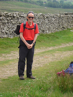
We had plenty of time to do the walk and had a couple of stops on the way up to the top. You can tell how warm it was because even Derek took his jacket off and we don't see that too often!


Once we left the summit all we could hear was the sound of skylarks above us as we made our way down hill with fabulous views of Swaledale and the village of Thwaite nestling amongst the fields of wild flowers. The only bit I didn't like was the rather rough and stony lane towards the end of the walk that was rather hard on the feet but the thought of cups of tea in Thwaite kept me going.
Apparently a 'thwaite' is a piece of land cleared of woodland for habitation.


Many of us visited the Kearton Guest House tea rooms, while others found a shady spot in which to relax.


William then treated us to a rather scary ride back to Hawes via the Buttertubs Pass. It was very spectacular but a bit unnerving if you were sitting on the lefthand side of the bus!


Sunday, June 14, 2009

Pennine Way 10 Horton to Hawes

Yet another day of glorious weather as we turned our backs on Ribblesdale and the famous three peaks of Pen-y-Ghent, Ingleborough and Whernside and headed across the watershed into Wensleydale. Most of the route today followed old packhorse trails and was well sign posted. My book said that 'even a lame packhorse with a coal sack over its head would have no problems'!


We seemed to have plenty of time to stop and stare and take in the splendid views.


Some of us took a slight detour to look at Calf Holes where the water falls into a sink hole before making our way to Ling Gill Bridge to eat our lunch and ponder or paddle as the mood dictated!


After lunch we climbed up to Cam End where the Dalesway meets the Pennine Way halfway between Horton and Hawes. At this point we realised we'd only done half the walk and picked up the pace a bit but most of the rest of the walk was downhill. It was good to see Ray back out again after his operation, taking a bit of gentle exercise!

By now the views had changed character as we approached Wensleydale and the village of Hawes. The meadows were a brilliant yellow colour and were full of millions of meadow buttercups. Apparently, according to an article in the Daily Mail, it is a good year for buttercups due to last year's torrential downpours and a warm spring. We are so lucky to have seen them at their very best as Hawes looked very inviting surrounded with a warm yellow glow.
Plenty of time for drinks, cups of tea, or fish and chips in my case before catching the coach home. Some of these photos, (the best ones probably!) were taken by Peter Newby who was reliving a previous experience of walking the whole Pennine Way in 15 days in 1999.

Sunday, May 17, 2009

Pennine Way 9 Malham to Horton-in-Ribblesdale


We started off in fine weather but with a poor forecast threatening to spoil the day. A steep climb up the steps at the left of the cove took us up on to the clints and grykes of the limestone pavement and it took quite some time for us all to make our cautious way across them. Thankfully the clints were dry and we all made it safely across without mishap.


Between Malham Cove and Malham Tarn there is a narrow enclosed dry valley known as Watlowes where the green turf is interspersed with outcrops of limestone, quite different from anything we had seen so far on our journey.


On past the tarn and the field study centre we soon emerged into open countryside again and Stuart announced an early lunch stop in the shelter of a wall as there was a cold wind blowing.
After lunch we made steady progress as the path took us gradually upwards to Fountains Fell . We had a second shorter stop just before we reached our highest point and this was very well timed as the weather turned showery as we left and dark clouds were amassing behind us.


As we descended the other side we got our first view of Pen-y-Ghent in the distance looking very formidable with clouds drifting across the summit now and then. It took us quite a long time to reach the beginning of the steep ascent and by this time the wind was strong and the rain was threatening to become more persistent so only six hardy souls decided to climb up to the summit. The rest of us, me included, were tempted by the thought of mugs of hot tea and toasted teacakes in the Pen-y-Ghent cafe and took the downhill option via Bracken-Bottom! Well we'd been up there many times before hadn't we and didn't feel the need to do it again in the rain.


Thanks to Jean Moxon for the photos of Pen-y-Ghent and the summit group. The rain did set in before they finished and the descent was a bit slippy so they didn't get time for any refreshment before we left. The 'A' party had finished quite early and spent some time in the pub where they picked up some extra passengers to drop off in Skipton, all good for the bank balance!

Sunday, May 3, 2009

Pennine Way 8 Thornton in Craven to Malham

I missed this walk as I was enjoying a holiday in Cornwall so many thanks to Colin Gregg for the following narrative and Jean Moxon who supplied the photos.

A short coach journey enabled us to make an early 10.15 start. Thornton in Craven greeted us with an overcast sky and a very cold westerly wind encouraging the group led by Rita to make a swift departure. Heading North out of the village via Cam Lane we soon entered beautiful rolling pasture lands contrasting with the nearby high moorland areas.

After a short time we reached the Leeds & Liverpool canal at East Marton passing under the famous No 161 double arch bridge which carries the A59 (T) over the canal. The nearby canal basin contains a number of interesting vessels.

By now the sun began to make an appearance through breaks in the cloud creating a distinct improvement in the temperature and this proved to be a continuing alternation throughout the day. The group continued to snake its way across more undulating fields and through occasional large clumps of trees while the air was filled with the bleating of very many spring lambs.

After crossing the Skipton/Settle railway line we soon found ourselves in Gargrave for a welcome comfort stop. Departing Gargrave in a northerly direction we encountered more rolling pasture land albeit at a much higher elevation and vast sprawling fields. On Eshton Moor in the vicinity of Haw Crag we halted for lunch giving us panoramic views of the surrounding fells, eastwards Rylstone and Flasby Fells along with Sharp Haw and northerly glimpses of the Craven fault.


Having enjoyed a well earned rest and lunch we gradually descended into the valley to follow the course of the infant River Aire for the few miles stroll to Malham. A light shower dampened our approach to the very early finish, some of the group taking advantage of the extra time to visit Janet's Foss.


Saturday 12 February 2011

I did this walk today on my own without getting lost! John dropped me off in Thornton in Craven at 9.20 a.m. and I got to Malham at 13.40 p.m.

It was similar weather to that experienced by the group, a grey start improving throughout the day with sunny periods and no rain thankfully, but plenty of mud as it had rained hard the previous day. The infant River Aire had plenty of water in it!

Thanks to Peter for lending me his strip map of the Pennine Way with helpful notes on it. There was just one point where I was puzzling which way to proceed across a field when a friendly farmer popped up and set me off in the right direction. Apparently I was heading for a post on the horizon but I'm afraid my eyesight is not that good! Anyway I did find the post and all was straight forward after that.

Thanks to John who provided transport there and back and was willing to find me if I got lost.

Sunday, March 22, 2009

Pennine Way 7 Ponden to Thornton-in-Craven


Another dry day but a very cold blustery wind blowing in our faces for most of the day. We set off along the side of Ponden Reservoir but soon started to climb quite steeply.


There were many signs of spring along the way with numerous sitings of primroses and baby animals.


The walk took us up on to Ickornshaw Moor where we stopped for a quick drink before making our way over the stone slabs and then down past several shooting huts.


Another stop for lunch in a sheltered gulley where contibutions were gratefully accepted from Stuart who had left his lunch on the kitchen table! No matter, he was soon well supplied with a sandwich, banana etc to see him through the day.


Another up and down mainly across fields and the village of Lothersdale with its large mill chimney comes into view.


One last climb for the day and we reached the highest point Pinhaw Beacon (1273 ft). By this time the wind was strong and we didn't linger long at the top. Just long enough to admire the splendid views in every direction.

Just enough time left to reach Thornton-in-Craven in time for the coach to pick us up at 5.00 pm. We have now completed approximately 63 miles of the Pennine Way and the best is yet to come!

Sunday, February 22, 2009

Pennine Way 6 Hebden Bridge to Ponden


A good turn out today, all meeting at Hebden Bridge, some on the train from Bradford and the rest on the bus from Keighley. The 'A' party set off along the canal to start at the point we finished at last time while the 'B' party opted for a bus up the hill to meet up with the Pennine Way at Colden. As it was a latish start and there would have been 14 miles to do it was felt that this was the best option and most people were in agreement with this. For the purists amongst us there will be an opportunity to do the missing couple of miles in the future. The bus took us up the steep hill to Heptonstall with its narrow cobbled streets and old buildings. We did have to wait a few minutes behind a parked ambulance until the paramedics had finished inside one of the cottages. The bus was very full and it was standing room only as it chugged up the hill. Thanks to Sheila for the photo. We missed out the steepest bit of the climb that day and were ahead of the 'A' party all the way into Haworth. The weather was fine again, a bit of a chilly wind later on but considering this has been the worst winter for a decade we have been extremely lucky on these walks so far.


4th April 2011 I met Jean Moxon at Hebden Bridge and we did the missing couple of miles in the rain! Thanks Jean for the next 3 photos.


As we set off on the the first steep climb looking back we could see Stoodley Pike standing proud on the other side of the valley


It was a day of moors and reservoirs but we managed to find a nice lunch spot at Graining Water and my Pennine Way book states that 'generations of Pennine Way walkers have eaten their lunch here'. A gentle climb up after lunch lead to the Walshaw Dean reservoirs and then on over the moors to Top Withens, said to be the inspiration for Wuthering Heights. Here a few of the group took the path leading more directly to Haworth while the rest of us followed the Pennine Way to Ponden Reservoir and then made our way to Haworth for the bus home.


Amazingly many of the 'A' and 'B' walkers caught the same bus out of Haworth to Keighley and ended a good days walk together. Next time we are back on our Sunday coach and maybe some of us will appreciate it more having had the inconvenience of using public transport on a Sunday to deal with!

Sunday, January 25, 2009

Pennine Way 5 White House to Hebden Bridge

Well here we are again on another fine day. A little bit cold but some sunshine and no rain to speak of. It was a bit of an effort for me to get to the beginning of the walk from where I live but 3 buses and 2 trains later here we all are.

It was a very easy walk today, the bus took us up the hill and all we had to do was walk on the flat to Stoodley Pike and then downhill all the way to Hebden Bridge. We could see the monument in the distance from a long way off. It is roughly 40 miles from the beginning of the Pennine Way at Edale.


If you follow the link you can read a little more about the monument and the inscription above the entrance that has almost worn away now.

We didn't linger long at Stoodley Pike as there was a cold wind blowing and we were all eager to gain lower ground where it was considerably warmer.


The final part of the walk took us down hill into the valley bottom. We stopped briefly in the sun for a drink and could see Heptonstall Church on the opposite hillside in the sunshine.


Once we reached the valley bottom we had a flat walk along the canal bank into Hebden Bridge. It was quite interesting to see all the canal boats moored and the gardens that had been made out of recycled items. Here we all dispersed for refreshments or the train station and a nice early finish.